wrf-python
A collection of diagnostic and interpolation routines for use with output from the Weather Research and Forecasting (WRF-ARW) Model.
This package provides over 30 diagnostic calculations, several interpolation routines, and utilities to help with plotting via cartopy, basemap, or PyNGL. The functionality is similar to what is provided by the NCL WRF package.
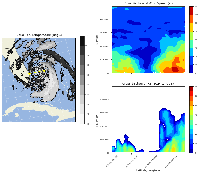
When coupled with either matplotlib or PyNGL, users can create plots like this:
Documentation
- What’s New
- Installation
- Table of Available Diagnostics
- How To Use
- Plotting Examples
- API Reference
- Frequently Asked Questions
- Support
- Contributor Guide
- Introduction
- Source Code Location
- Ways to Contribute
- Ground Rules
- Submitting Bug Reports
- Submitting Fortran Computational Routines
- Submitting Python Computational Routines
- Submitting Fully Wrapped Computational Routines
- Fixing Documentation Errors
- Creating New Examples
- Setting Up Your Development Environment
- Code Style
- Pull Requests
- Tests
- WRF-Python Internals
- Citation
- License
- Tutorials
Indices and tables
The National Center for Atmospheric Research is sponsored by the National Science Foundation. Any opinions, findings and conclusions or recommendations expressed in this material do not necessarily reflect the views of the National Science Foundation.